For my GIS/Cartography work during my undergraduate and graduate education, please see below.
This map shows the alumni for the entire US as well as international members.
This map shows the geosciences alumni by employer type for 2019.
This map shows the geosciences alumni by degree and major for 2019.
This map shows the alumni and association makeup for Kansas for 2019 from FHSU.
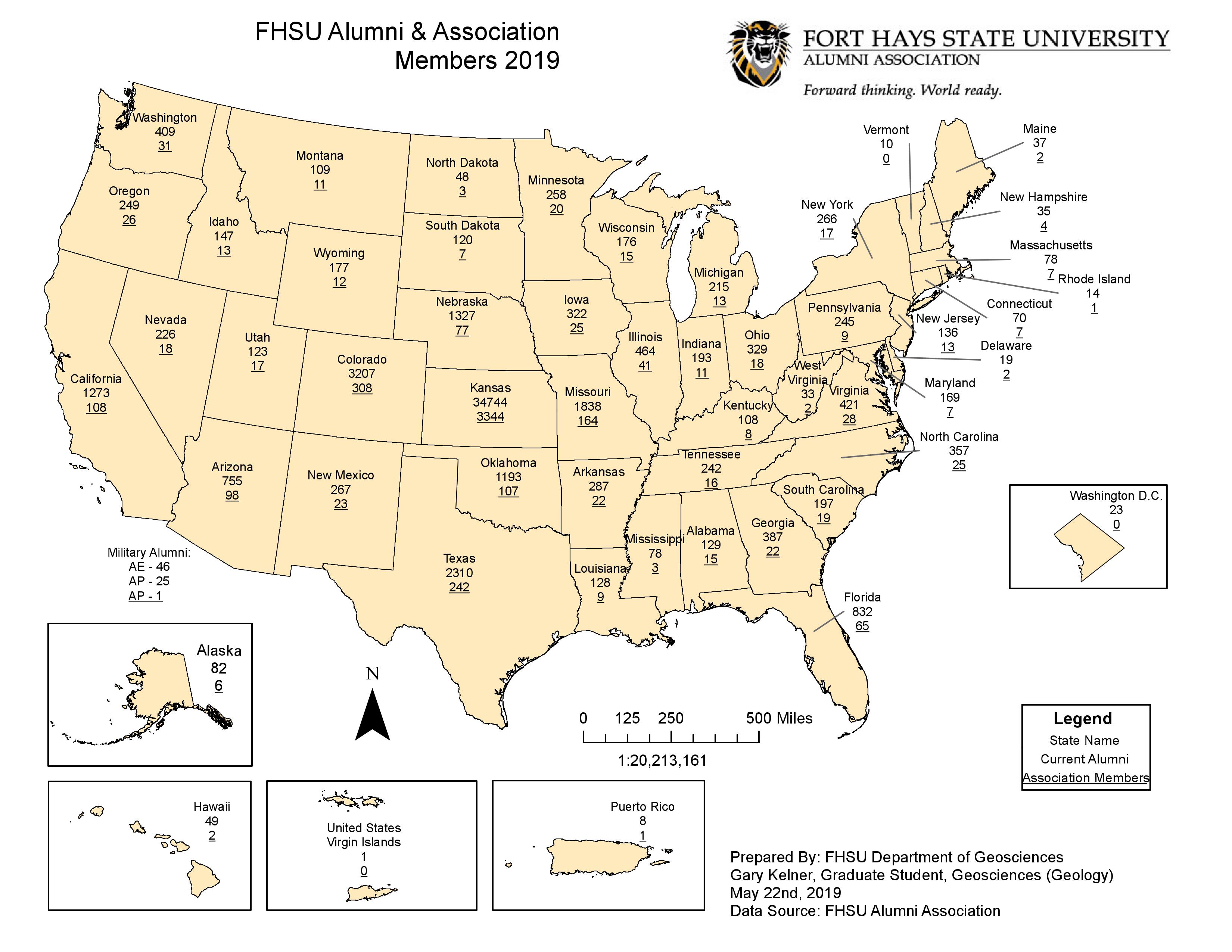
This map shows the alumni and association members of FHSU for 2019.
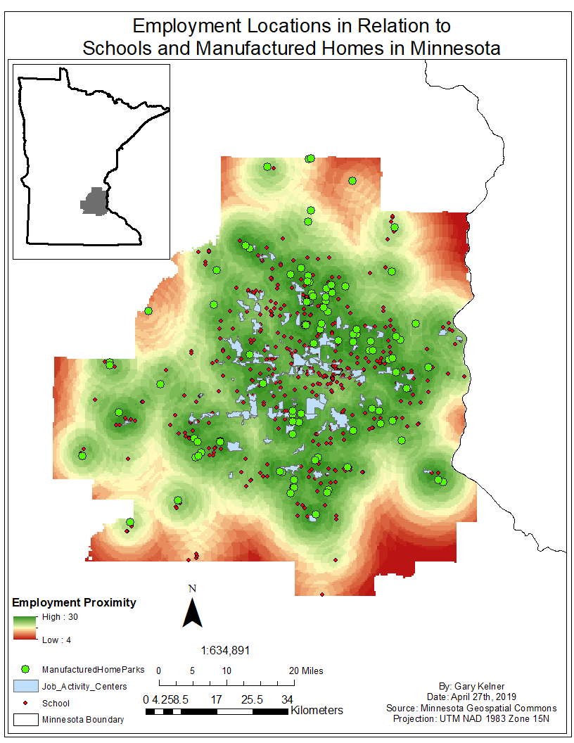
This map was made as part of the final project for GSCI 625: Advanced GIS that I completed in the spring of 2019. This map was made using ESRI ArcMap version 10.6.1.
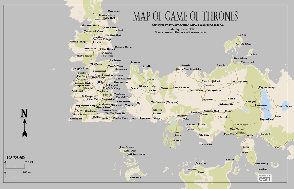
This map was created using Adobe Maps for Creative Cloud and the online map created by CreativeCarto.
For my GIS/Cartography work during my undergraduate education at the University of Minnesota Duluth, please take a look at the maps below. Still under construction.
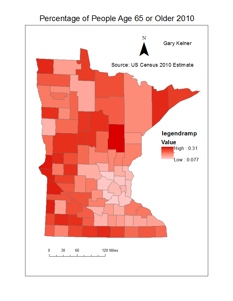
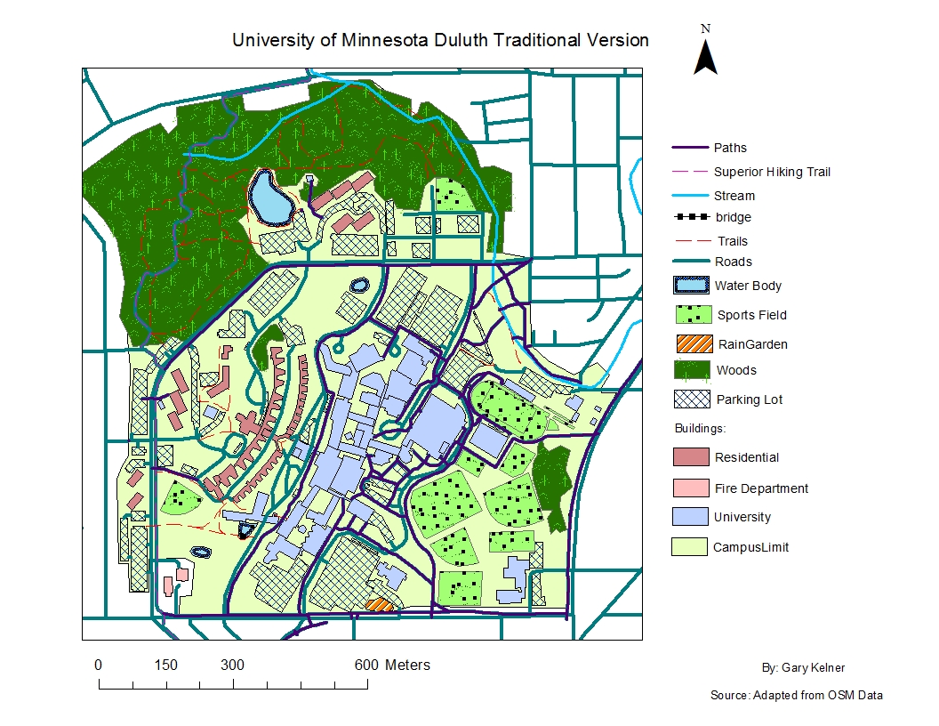
This map was created during the Map Design course of my undergraduate education.
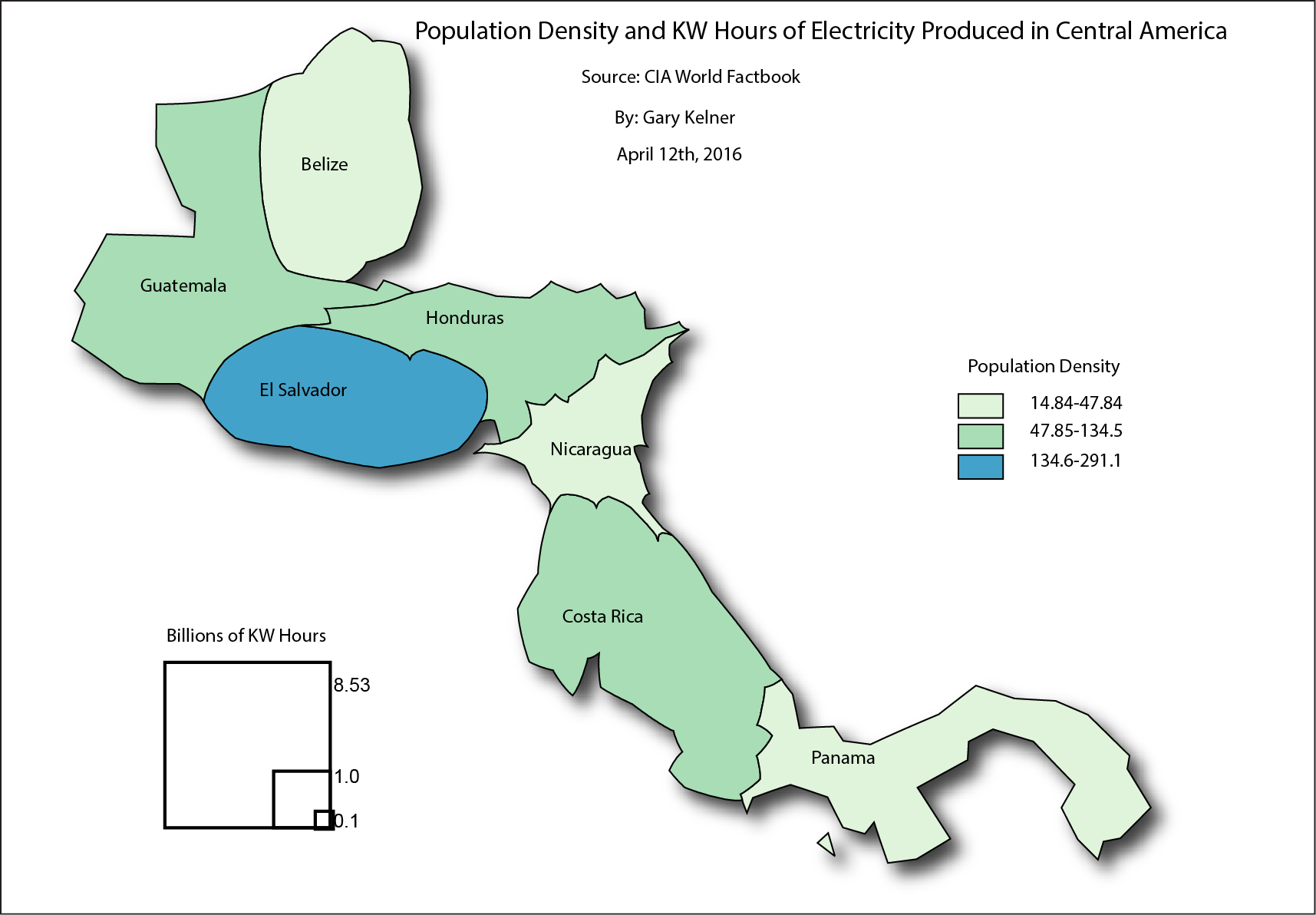
This cartogram was created during the Map Design course of my undergraduate education.
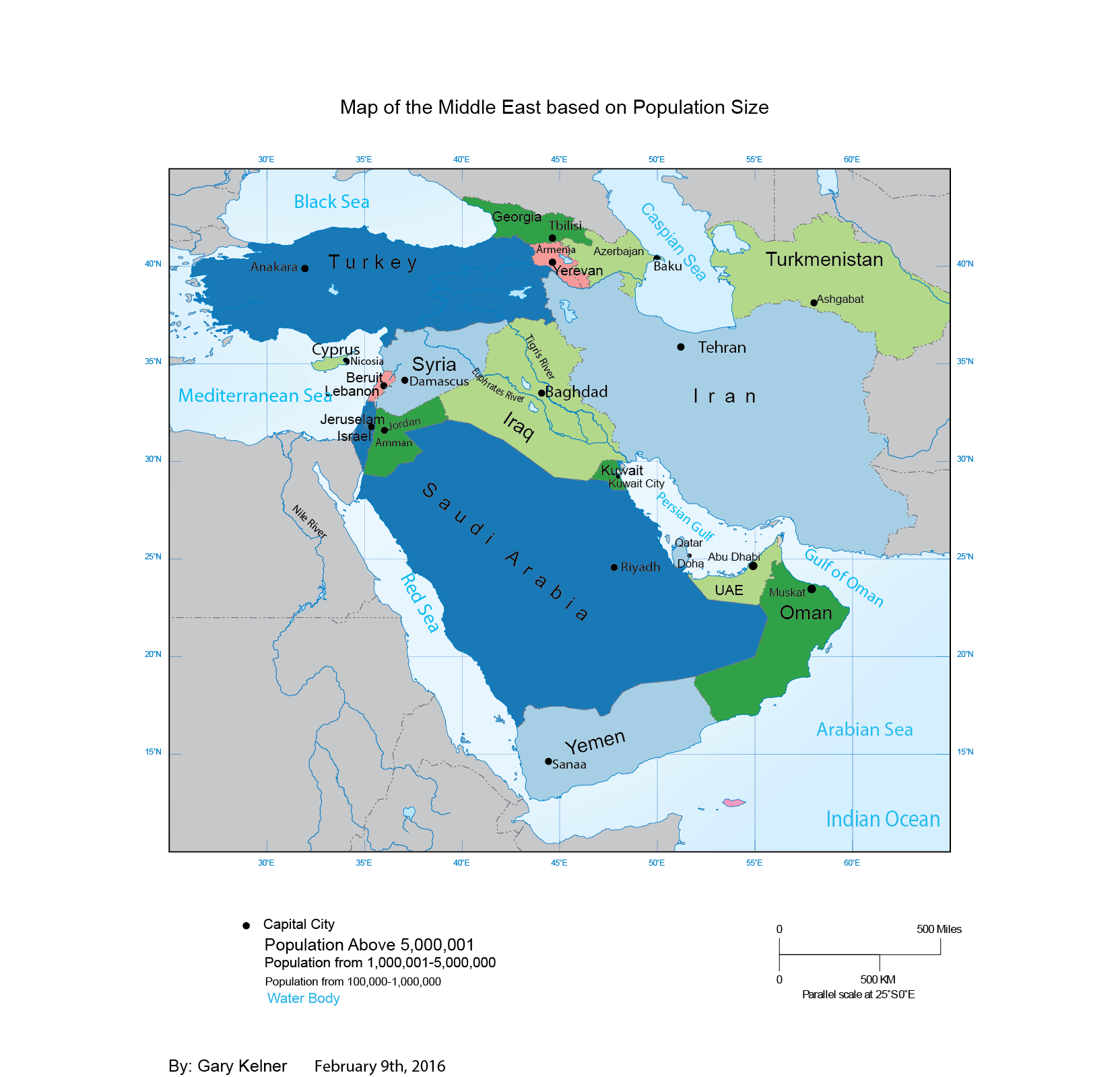
This map was created during the Map Design class of my undergraduate education using Adobe Illustrator and ArcGIS Desktop.
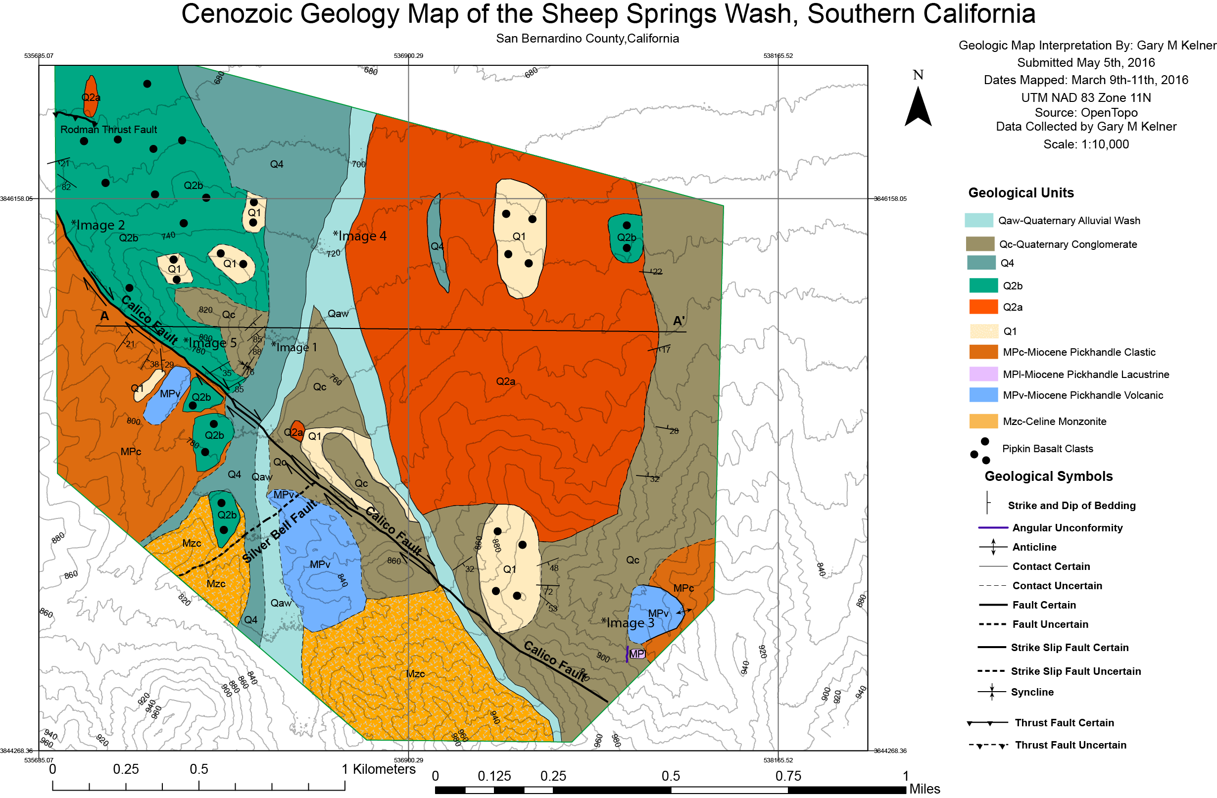
This map was created during the final semester of my undergraduate education. The data was collected by hand and then digitized into the final map using ArcGIS Desktop. This map won the category of best undergraduate cartography in the University of Minnesota U Spatial Mapping Contest for spring 2016. https://research.umn.edu/units/uspatial/mapping-prize/2016-best-maps
